← Back
Where Science and History Intersect: The Hermione’s Contribution to Operational Oceanography

A tribute to history with a scientific purpose
The French tall ship, Hermione, an exact replicate of the original Hermione, which ferried General Lafayette to the United States in 1780 to fight alongside the Americans during the Revolutionary War, arrived in Yorktown, VA, USA, on June 5th. 2015. The 80 member-crew left LaRochelle in France on April 18th, and finally arrived at Yorktown, its first stop, before visiting a number of ports on the U.S. East Coast (including Alexandria, New York and Boston), a tribute to the moving two centuries- old history shared by the French and Americans.
But the project is not only about history. It is also about helping scientist to predict the future by contributing to ocean and climate research.
4.000 floaters profiling the ocean
Using sailboats to deploy scientific instruments is encouraged by the operational center of the UNESCO and JCOMMOPS, hosted by CLS and IFREMER. Several different ocean users (school boats, explorers and racing ships, etc.) have already deployed hundreds of floats.
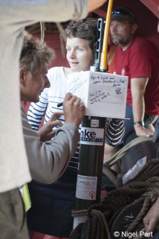
Within the framework of an international program led by Argo and supported by its French component Coriolis, Hermione was equipped with two profiling floats, that the crew deployed into the ocean during the transatlantic journey. The Coriolis project regroups actors such as the CNES, the CNRS, theIPEV, the IRD, Météo-France, the SHOM and scientists coordinating the missions. Almost 4000 floats have already been deployed globally, and the number is increasing thanks to ships like the Hermione, who contribute to completing the spatial distribution of the existing array. In addition, this project raises citizens awareness about ocean observations.
Once deployed, the float descends to a target depth of 1000m to drift for approximately 8 days, and then pursues its descent down to 2000m. At the end of the cycle, the float rises back to sea surface and transmits the collected data via the global Argos satellite system. The floats are designed to repeat these 10 days-cycle for at least 5 years, until batteries are discharged.
An ocean-atmosphere systemic approach providing a better understanding of our climate
These autonomous “ocean sentinels” as many scientists like to call them, provide data related to sea temperature and salinity levels, which are first sent to the CLS processing center, then validated and distributed by Coriolis, which is the center for data quality control and analysis.
The project also contributes to the development of more accurate climatic predictions and to a better understanding of the ocean-atmosphere dynamic system, which is shaping our climate. Argo has considerably improved the quality of oceanic forecasts, which is crucial in order to develop long-term seasonal climatic predictions. The collected data is thereby helping marine surveillance to adapt their management strategies in favor of better ocean conservation.
Usefiul Links:
- About the Argo program


