← Back
How Endangered Species Such as Marine Turtles Use Marine Protected Areas?
")
Marine Protected Areas are one of the main instruments for endangered species protection.
Argos can help in defining their outlines to have the best impact, especially when a large number of tracks is available for habitat analysis and modelling. Example with marine turtles in the Floridian ecoregion.
Defining Marine Protected Areas (MPAs) outlines
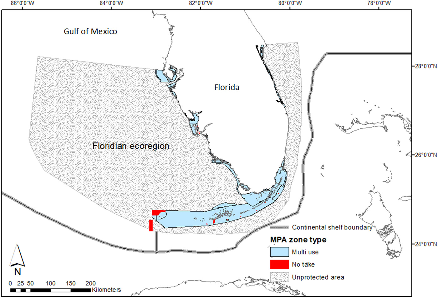
Map of the ecoregion and Marine Protected Areas included in the study (from [Roberts et al., 2021])
Establishing Marine Protected Areas (MPAs) is one of the key solutions for endangered species protection and for sustainable use of the resources. The regulations can vary widely from one Marine Protected Area to another, or even within a given Marine Protected Area. Some enforce strict protection with no exploitation permitted at all (‘no take’), while others allow for some such activities of different scope or public (‘multi-use’).
Defining the Marine Protected Areas outlines, and the regulations applied within, is not simple, especially with an environment as ever-changing as the ocean. Ideally, the protected area should encompass habitats crucial for the conservation of some chosen key species. Delineating areas of high use or high biodiversity can thus be important. However, with migratory species, the habitat is not the same depending on the seasons. Argos satellite telemetry can help in asserting if some key species are using a given Marine Protected Area, and when.
Analysis of marine turtles’ tracks in the Floridian ecoregion
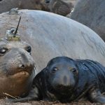
Marine turtles can be considered as focal species for biodiversity protection, and are highly mobile. They are the animal genus the most tracked using Argos from the earliest time of animal tracking applications (see Sea turtles in tropical cyclones, Juvenile green turtle individuals behave differently, satellite telemetry reveals, Two very different destinations for two adventurous turtles, Olive Ridley turtles help in ocean climate forecasting or Understanding the tracking of three loggerhead turtles with ocean data…). A population of them can be found in the Floridian ecoregion, with tracking efforts ongoing for many years.
A 11-year satellite-tracking dataset on 235 marine turtles is thus available. It encompasses three different, endangered, species, loggerhead (Caretta caretta), green (Chelonia mydas), and hawksbill (Eretmochelys imbricata) turtle. The animals were tagged in four locations in Florida and the Gulf of Mexico, after being captured either in the water of after nesting.
More info about animal tracking with Argos
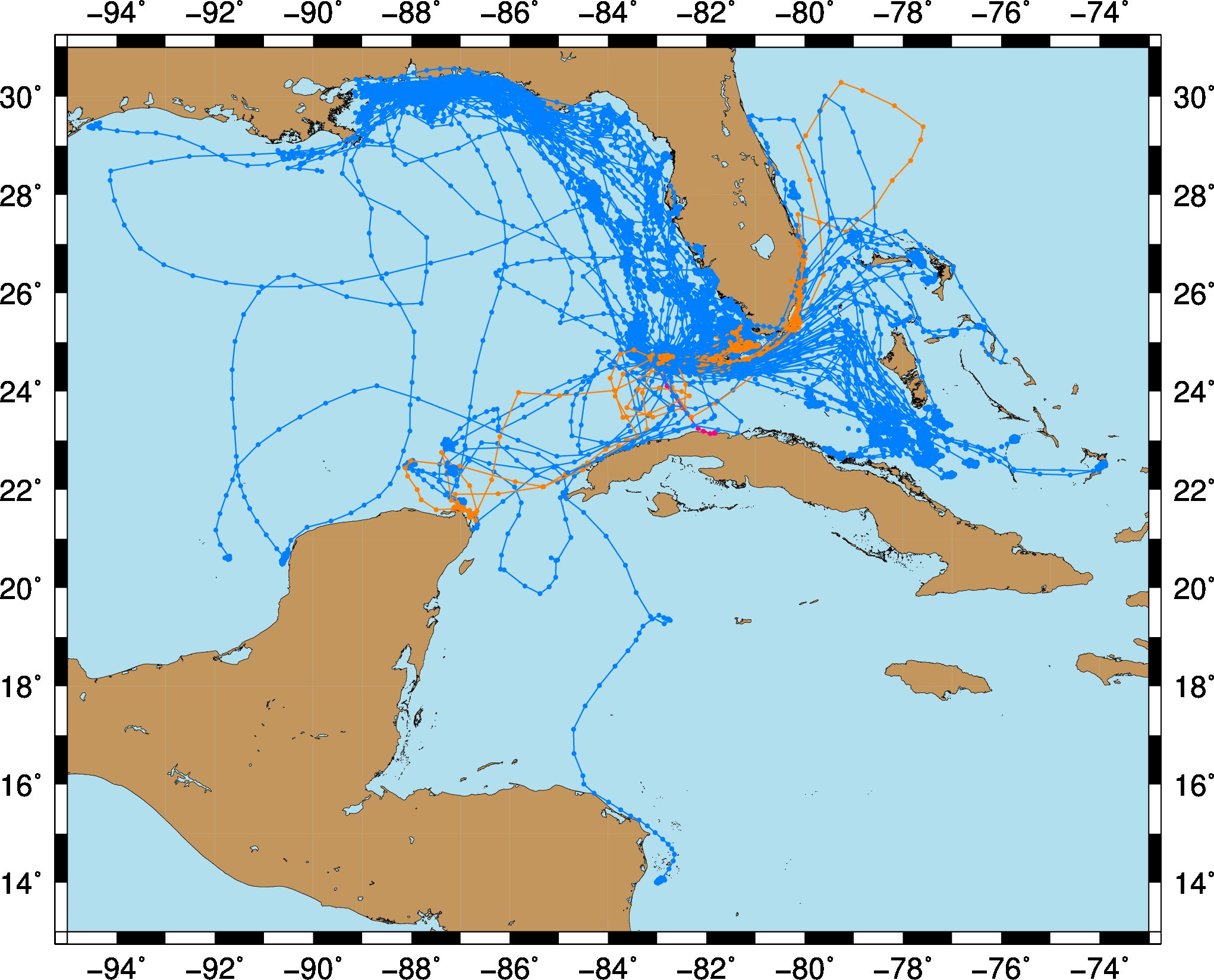
All the 235 tracks used in the study (blue, Loggerheads, orange, green turtles, red hawksbills). The higher density of locations in some areas is clearly visible.
However, the locations are irregularly sampled within a track. By computing intermediate steps within the followed path, using integrated step selection analysis technique, such gaps can be filled. This technique enables to estimate the probability of selection of different habitats as well as the movement properties of the animal’s trajectory when not selecting one of those habitats.
The effects of sea turtle behavioral state, protected area kind (no take or multi-use), chlorophyll and bathymetry on habitat selection was thus quantified.
Turtles’ use of Marine Protected areas
Among the results, it seems that marine turtles show no preference for the ‘no take’ areas. This can be linked to the scarcity of them and to their small size. It may also be a real choice by the turtles, which could mean that those ‘no take’ areas do not fit those species’ needs.
Among the environment variables, correlation with high chlorophyll areas is not conclusive, since those are shallow waters areas in the region, and thus could be linked to other kind of vegetation, and/or to suspended matter.
The Florida Keys National Marine Sanctuary (FKNMS) makes the bulk of the protected area included in the Floridian ecoregion. Its boundaries, zone and regulations are currently being revised, with expansion in mind. The results of the study on marine turtles, and the application of the method to other endangered species could provide a rationale for future definition of this particular Marine Protected Area and for others. This could help management of existing Marine Protected Areas or changes, specifically multi-use to no-take zoning.
Reference & links
Roberts KE, Smith BJ, Burkholder D, Hart KM. Evaluating the use of marine protected areas by endangered species: a habitat selection approach. Ecol Solut Evidence. 2021;2:e12035. https://doi.org/10.1002/2688-8319.12035