← Back
Dugong Movements and Habitat Use in Coral Reef Lagoons
")
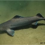
Dugongs are vulnerable herbivorous marine mammals living in tropical and subtropical coastal waters, including in coral reef lagoons. Their behaviour there is however little known.
Argos enabled to track them in such environments around New Caledonia.
Only surviving member of its family
The dugong (Dugong dugon) is the only strictly-marine herbivorous mammal. It occurs in tropical and subtropical coastal and island waters of 46 countries from East Africa to Vanuatu. It is the only surviving member of the family Dugongidae, and is listed as Vulnerable to extinction at a global scale by the International Union for Conservation of Nature (IUCN).
The dugong is of high biodiversity, cultural and traditional value across its range, while it is considered to be at high risk of local extinction in multiple parts of it. In some regions such as the Pacific island region its conservation status is currently considered unknown, partly because of a general lack of information on the species population demographics and spatial ecology.
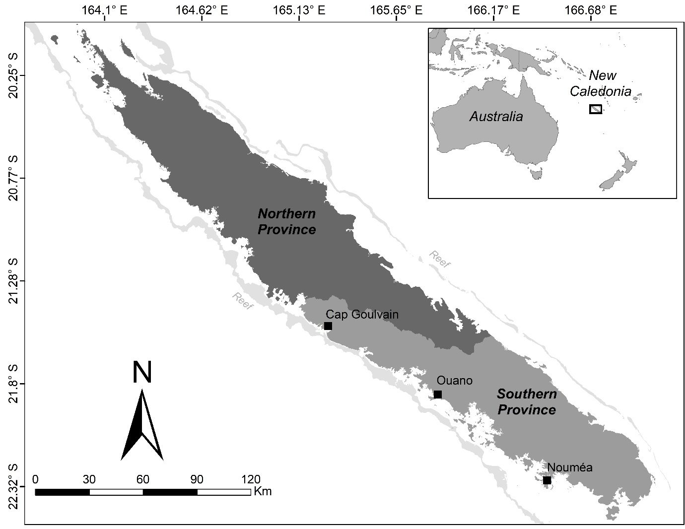
Locations of the three dugong satellite tagging sites (black squares): Cap Goulvain (7 dugongs), Ouano (2) and Nouméa (3). (Credit Christophe Cleguer)
Tracking dugongs in New Caledonia
In particular, little is known about how the dugong uses coral reef lagoons despite their being important habitats throughout much of its vast range. How dugongs use space has mostly been studied in Australia where the continental shelf is wide. In some regions like the coral reef lagoons of New Caledonia, the width of the lagoons and in some areas, tides, may substantially restrict the dugong’s movements, and thus constitute a completely different habitat to explore.
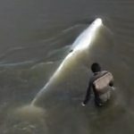
We equipped twelve adult dugongs (seven females and five males) with GPS-satellite tracking PTTs using Argos to document their space use of coral reef lagoon environments of the Oceania island region for the first time. The tagging was led at three localities in the lagoons of the main island of New Caledonia in the southwest Pacific, an island located at the eastern edge of the dugong range. The dugongs were tracked between 3 and 192 days (mean = 35.9 days, median = 18 days).
More info about animal tracking with Argos
Dugongs movements in coral reef lagoons
The movements of the tracked dugongs were individualistic and all except one animal undertook large-scale movements from their capture location (i.e., longer than 15 km; up to 73 km). The twelve dugongs spent most of their tracking time within the lagoons with 99.4 % of locations found inside the barrier reef. The use of the coral reef lagoons by the dugongs reflected each lagoon’s size and depth. This suggests that dugongs are well adapted to a range of geomorphological settings, giving them an adaptive advantage that might enable their widespread distribution.
We also identified areas where we did not know from past aerial surveys that dugongs were hanging out. Where the lagoon is narrow and confined, three tracked dugongs used the fore reef shelf outside of the barrier reef in the open ocean to commute between bays. This is the first proof of the dugongs’ use of a fore reef shelf in the open ocean as a movement corridor.
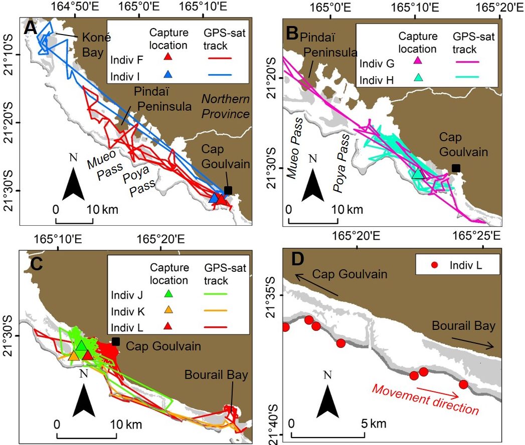
(A), (B) & (C): Movements of the 7 dugongs tracked in the Cap Goulvain region. (D) An example of a tracked dugong travelling through oceanic waters and using the fore reef shelf outside the lagoon to go from Cap Goulvain to Bourail Bay. Brown represents land, dark grey represents barrier reef and light grey represents the reefs inside the lagoons (Credit Christophe Cleguer)
Bio-indicators of seagrass
We identified areas used intensively by 10 of the 12 tracked dugongs in all three study locations, some of which were areas where seagrass presence has not been verified.
Dugongs are known to be excellent bio-indicators of seagrass presence and seagrasses are among the most valuable ecosystems on earth and of fundamental importance to human life, yet their spatial extent and distribution for much of the globe is unclear. Thus, the data we have collected on the dugongs’ use of space could be used to direct in-water sampling to assess the benthos habitat and to verify the presence of critical seagrass habitats.
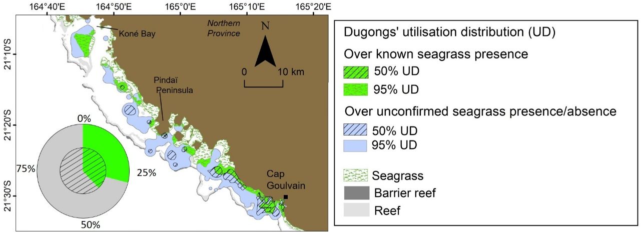
Relationship between the space use of dugongs captured in Cap Goulvain and the known shallow seagrass habitats. Pie chart represents the proportions of 95 % utilisation distribution (outer ring) and 50 % utilisation distribution (inner ring) of dugong areas where the presence of seagrass has been confirmed (in green) or is unconfirmed (in grey). (Credit Christophe Cleguer)
Conservation and management initiatives
Our findings are now in the hands of the resource managers in New Caledonia and will hopefully inform conservation and management initiatives locally as well as in other countries within the dugong’s range with similar habitat geomorphology but where dugongs occur in numbers too low to be tracked and are considered Critically Endangered.
Reference and links
- Cleguer, C. Garrigue, H. Marsh, 2020: Dugong (Dugong dugon) movements and habitat use in a coral reef lagoonal ecosystem, Endangered Species Research, https://www.int-res.com/abstracts/esr/v43/esr01061
- ENTROPIE