ArgosWeb: Quick Start Guide
The ArgosWeb Quick Start Guide will give you the first steps to use ArgosWeb.

ArgosWeb User Manual
Quick Links
Menu & Settings

Search & Get Data
Display your Data
Download your Data
Multi Site Access and User-Friendly Platform
This quick-start guide is intended to provide a brief explanation of the standard buttons and how to access some of the most used features in ArgosWeb.
This version works on all browsers and tablets (Android, Ipad). For Internet Explorer user, we recommend at least IE 9.
Greater detail is available in our full-length User Manual online or contact your local correspondantwhich you can find here.

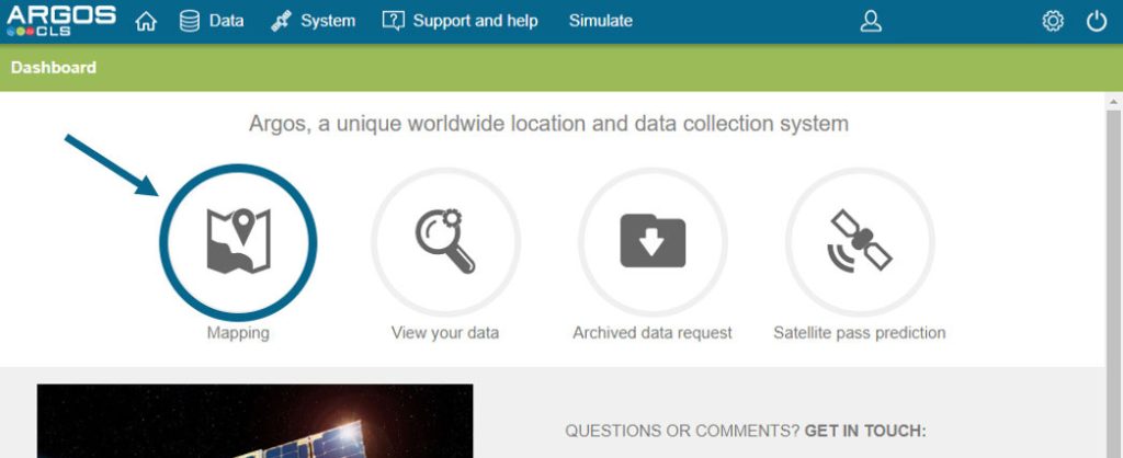
Quick Links
- Mapping: Quick link to mapping tool
- View Your Data: Quick link to the Argos Messages
- Archived Data Request: Quick link to request archived data
- Satellite Pass Prediction: Quick link to the satellite pass prediction tool
Menu and Settings

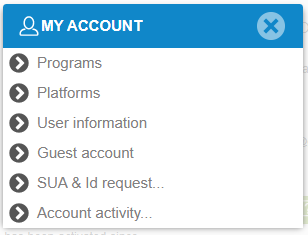
Account Management
This menu allows you to access your user, program and platform information.
From here, you can also add/delete guest accounts, renew your SUA, request new ID numbers and view your account activity.
Settings
This menu allows you to change the preferences. Very useful to select the language and change the format which will be used in the data grid.
Search and Get Data
-
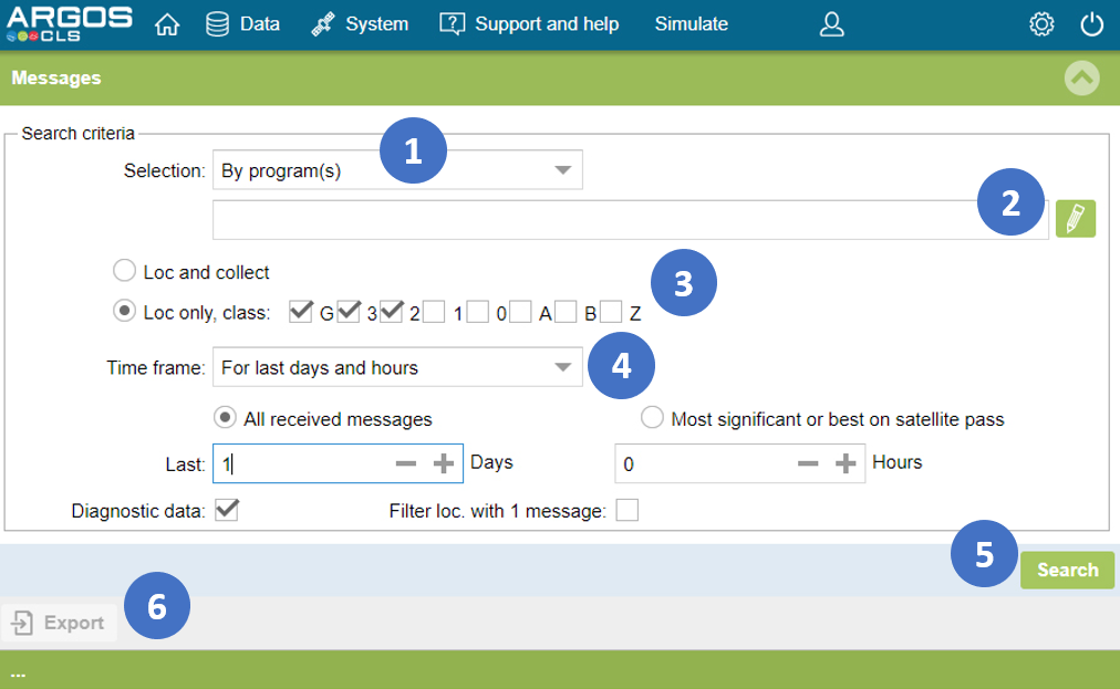
- Set selection criteria
- Edit platform or program list
- Select location classes to display
- Set time frame and parameters (20 days max)
- Request your data
- Export grid data
If the results are not satisfactory, please reviewor clear the grid filters.
The last 20 days are available.
The “most recent data” option displays the latest data, whatever the date.
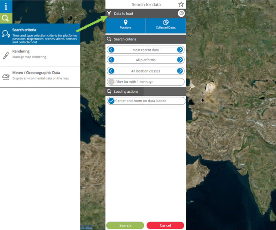
Display your Data
Click on the quick link to mapping tool from your dashboard.
Then:
-
- Open the positions search menu
- Choose your criteria
- Click search to see the results
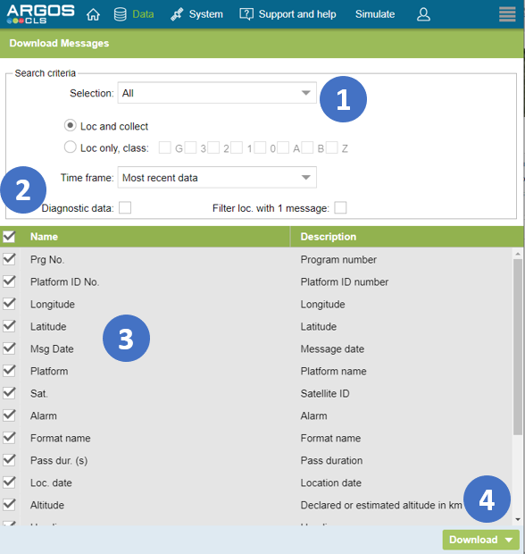
Download your Data
-
- Set selection mode and parameters
- Select all colums
- Or select only column to download
- Download your data
The last 20 days are available.
The “most recent data” option displays the latest data, whatever the date.
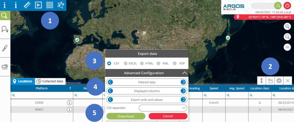
Download your Data
from the Mapping Tool
- Choose Display position grid
- Click on ‘Export data’ button
- Choose your format
- Allows you to choose between exporting all or filtered data and only the displayed columns or all columns
- Download your data
If filters have been applied they will be applied when exporting.
For regular and simple data exports we recommend downloading via ArgosWeb.
