← Back
Leatherback Turtles Nesting in Equatorial Guinea
")
Tracking leatherback turtles can help in protecting them at both a local scale, close to their nesting beach, and a basin-scale, when they migrate.
The population from the Gulf of Guinea is currently the world’s largest, but fisheries, removal of adults from beaches and the impacts of climate change threaten the species.
The leatherback turtle (Dermochelys coriacea) is a long-distance migratory sea turtle. Satellite telemetry has enabled conservation scientists to describe leatherback turtle behaviour and ecology at sea, revealing the fascinating migrations these animals undertake. Coupling of foraging location data along with information on human activities has pinpointed areas of conservation concern.
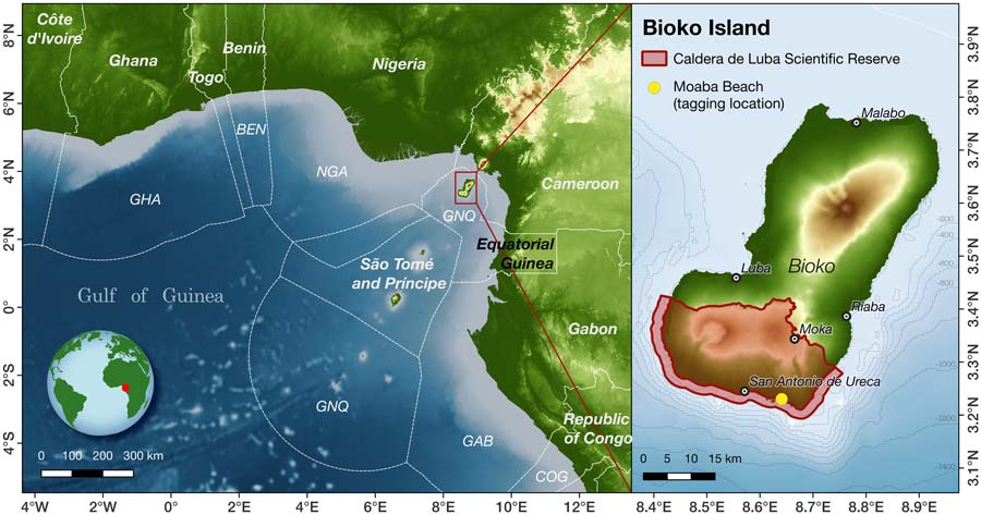
The Gulf of Guinea in the South Atlantic Ocean, to the west of the African continent, has the world’s highest concentration of nesting leatherback turtles. Gabon’s nesting population is the largest but other nesting sites such as on Bioko Island, part of Equatorial Guinea, host significant nesting effort and may be connected to nesting populations on the African mainland.
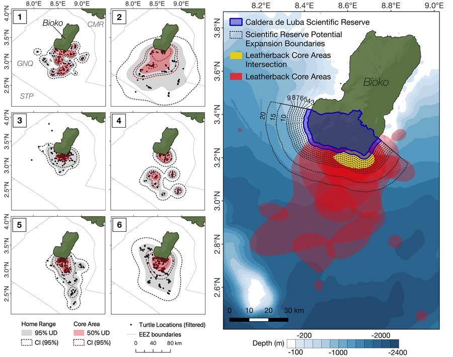
Nesting core habitat of leatherback turtles during internesting period
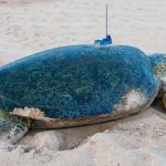
Ten female leatherback turtles were satellite tagged in Bioko Island at a nesting beach in the southern Caldera de Luba Scientific Reserve. To record nesting attempts, and discriminate between inter-nesting period and migration, satellite tags were programmed to record and transmit information on the percentage of time the tag was dry, along with information on position.
Home range and core area distributions were generated for each tagged turtle. The core areas of distribution (i.e. the 50% utilisation distribution) were focused in proximity of the nesting beach where they were tagged, extending 10 km offshore, though some individuals also went further offshore (up to 75 km). The leatherback females remained exclusively within Equatorial Guinea waters during their breeding season, yet spent less than 10% of the time within the current protected area.
More info about animal tracking with Argos
Migration of post-nesting leatherback turtles
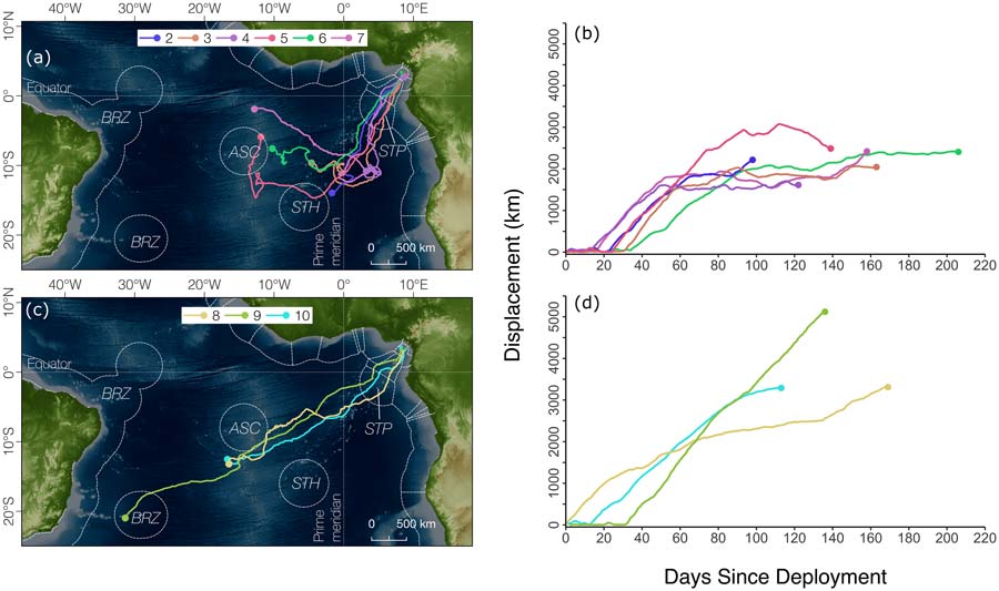
Post-nesting displacement from the nesting beaches was calculated for each tagged turtle. Turtles began migrating immediately after their final nesting attempt. One group (representing 6 individuals) spent time in the Central Atlantic Ocean, and displayed more tortuous focused movements within the region. The other group (three individuals) moved directly across the Atlantic Ocean, towards the coast of South America, up to 5119 km from the tagging site. These post-nesting strategies closely resemble those of the Gabonese population, also revealed by satellite tags working on the Argos System.
The levels of fishing threat are estimated be high in waters surrounding Ascension Island and along the coast of Brazil. Both areas are located along migration routes of the Equatorial Guinea population, or overlap with their feeding grounds. These threats should be different for the two migratory groups, exposed to either longlining or purse seining activities, which are distributed unequally. The Gabon population should also be concerned, due to the similarity in migration routes. Other studies would be needed to further elucidate patterns of interaction and behavioural responses of turtles to fisheries within the region.
Reference & links
- Garzon F, Barrientos C, Anvene RE, Mba FE, Fallabrino A, Formia A, et al. (2023) Spatial ecology and conservation of leatherback turtles (Dermochelys coriacea) nesting in Bioko, Equatorial Guinea. PLoS ONE 18(6): e0286545. https://doi.org/10.1371/journal.pone.0286545
- Tortugas Marinas de Guinea Equatorial (TOMAGE): http://www.seaturtle.org/groups/index.shtml?view=180