← Back
Philippine eagles forage in human fragmented forests
 and after being fitted with a satellite transmitter (right) (credit: Philippine Eagle Foundation)")
Protecting critically endangered species aims to better assess where and when the main threats to these species occurs. Using satellite telemetry technology, Philippine eagles were tracked to define their home range and habitat use across their tropical forest breeding grounds and within human-occupied areas.
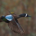
Main Photo: A Philippine eagle in the wild (left) and after being fitted with a satellite transmitter (right) (credit: Philippine Eagle Foundation)
The Philippine eagle (Pithecophaga jefferyi) is a large tropical forest raptor (bird of prey) endemic to four islands in the Philippine archipelago: Mindanao, Leyte, Samar, and Luzon. They are currently classified as ‘Critically Endangered’ on the International Union for the Conservation of Nature (IUCN) Red List, with a breeding population provisionally estimated between 258-362 adult pairs1. Philippine eagles mainly inhabit the remaining areas of lowland and montane tropical forest, where heavy deforestation for logging and agricultural land is ongoing. Because of this the main threats to the species are habitat loss and direct human persecution when the eagles come into conflict with humans.
To identify the ecological needs of an animal, the notion of home range can be used, and computed from satellite telemetry locations. An animal’s home range is defined as movements used for foraging and breeding on a regular basis, excluding the occasional explorations outside of it. Even though the Philippine eagle is a species is at high risk of extinction, typical home range size and habitat use are mostly unknown for this raptor of conservation concern.
Home range estimators from satellite telemetry Philippine eagles’ locations
A yet unpublished study2 used satellite telemetry locations from six GPS tagged adult Philippine eagles (four of which are Argos Platform Terminal Transmitters (PTTs)) to estimate home range size and quantify habitat use. From the 74,098 unique positions, five different home range estimators were tested to estimate the probability of an individual being located within a given area (here termed the 95% and 50% utilization distribution).
Resource selection was estimated using the GPS locations and three habitat covariates (leaf and canopy structure; old growth biomass, Enhanced Vegetation Index) derived from satellite remote sensing data obtained from the MODIS sensor onboard the NASA Terra and Aqua satellites. Enhanced Vegetation Index was used because it has shown to be better at capturing dense vegetation characteristics and canopy structure in tropical regions than other vegetation indices.
More info about animal tracking with Argos
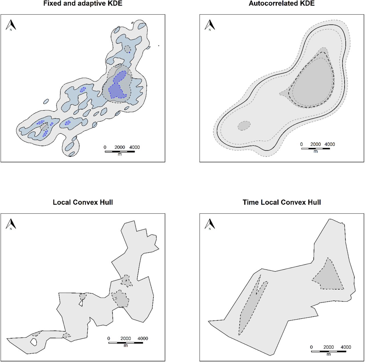
Home range estimates for one of the Philippine Eagles (an adult female), using five different home range estimators (KDE = kernel density estimate). Light grey with solid black lines is 95% Utilization Distribution, and dark grey with hashed black lines 50 %, except for the adaptive KDE for which 95 % home range is shown in light blue with solid black line and 50 % core range in dark blue with hashed black line. For the autocorrelated KDE 95 % Confidence Intervals are shown by hashed light grey lines. (adapted from Sutton et al. 2022b)
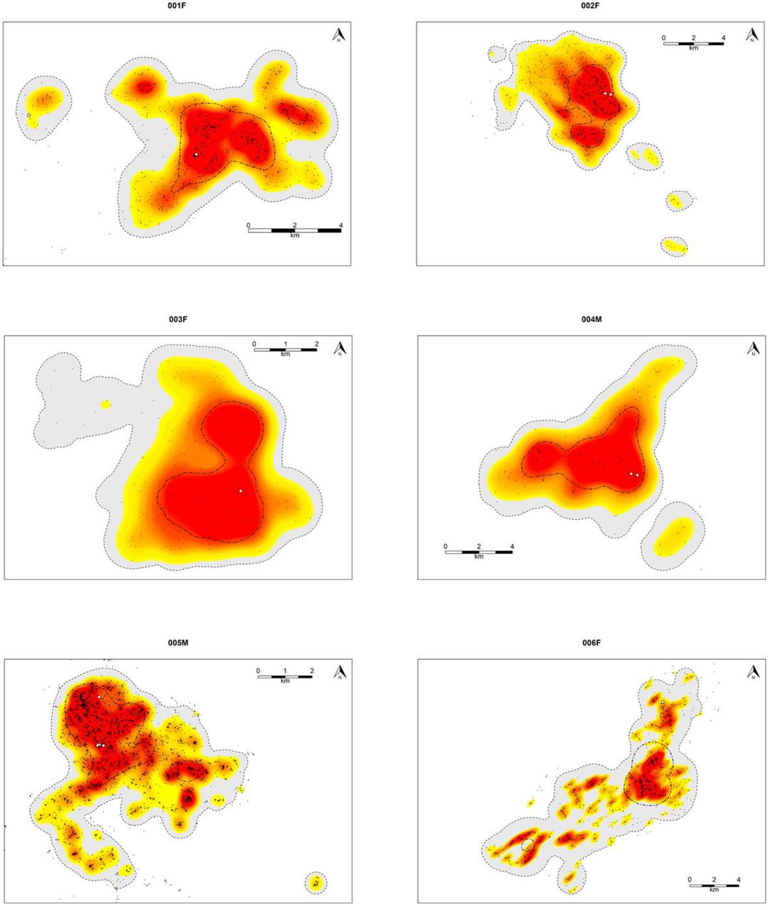
The estimates from all six tracked eagles using the fixed (grey & black dot-dash line) and adaptive (yellow-red) kernel density estimates. Black points show filtered locations using a 3-hr sampling interval for each respective adult Philippine Eagle. White points indicate nest sites. (adapted from Sutton et al. 2022b)
Results from the five estimators were noticeably different for each of the individual eagle tracked, probably due to varying need and fragmented forest. Overall, adult Philippine eagles were estimated to be using 75-80 % of space-time use outside of their core territorial area, presumably when foraging within their home range. The habitat use analysis showed that foraging areas are generally outside of old growth forests. This is possibly related to the eagles foraging over secondary forest and cleared agricultural lands, along forest edges. Those areas are distant from the nest sites, which are generally situated within denser forest areas.
Perspectives for conservation of Philippine eagles
Using satellite telemetry locations from the six adults enabled the biologists to capture the fine scale resource use within each eagles’ respective home range. Because Philippine eagles appear to prefer forest edges and clearings, which are also the areas occupied by humans, the probability of negative encounters with humans is high, leading to death or severe injuries. The authors concluded that directing localized conservation action towards the reduction of such conflicts and promoting eagle-friendly lifestyles within forest communities should be promoted.
The implementation of a range of space use estimators, along with easily interpretable resource selection functions can thus help inform conservation management. It is recommended that such model outputs should be interpretable to conservation practitioners to help focus management actions where they are most needed.
References
- 1 Sutton, L.J., Ibañez, J.C., Salvador, D.I., Taraya, R.L., Opiso, G.S., Senarillos, T.L.P. & McClure, C.J.W. (2022a). Priority conservation areas and a global population estimate for the Critically Endangered Philippine Eagle derived from modelled range metrics using remote sensing habitat characteristics. bioRxiv. DOI: https://doi.org/10.1101/2021.11.29.470363
- 2 Sutton, L.J., Ibañez, J.C., Salvador, D.I., Taraya, R.L., Opiso, G.S., Senarillos, T.L.P. & McClure, C.J.W. (2022b). Space-time home range estimates and resource selection for the Critically Endangered Philippine Eagle on Mindanao. bioRxiv. DOI: https://doi.org/10.1101/2022.05.19.492630